Hello from Montreal: Exploring Montreal by Bike – The Official City Tour
Well, after a more than filling dinner at La Iguana and a brief excursion to Montreal’s Jazz Festival last night it was time to burn some calories and an official biking tour through the city would help me keep the certain weight gain from the delicious Montreal food at least somewhat under control. My biking tour was scheduled to start around 8:30 am, but on this gorgeous day, Canada Day no less, our national holiday, I got going early.
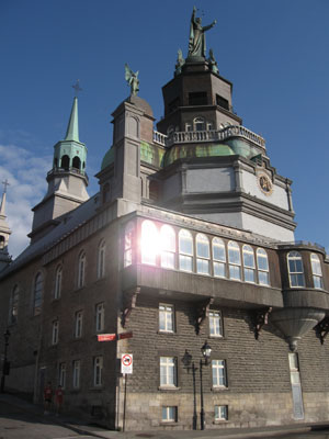
Early morning sun reflecting on the Chapelle Notre-Dame-de-Bonsecours
Bright and bushy tailed I walked out of the hotel by 7 am and strolled over into Old Montreal. Jacques Cartier Square at 7 am was pretty much deserted with just a few people opening up cafés and street vendors starting to open their stalls. Further south the sun was reflecting off the silver dome of the Marché Bonsecours I noticed that runners dressed up in red t-shirts with the slogans “Run for Canada” and “Great Things For Canada” were congregating in the port area at Quai Jacques Cartier.
Upon further investigation I found out that all these athletes were raising funds for Canada’s Olympic teams for the 2010 Vancouver Olympics as part of a charity event organized by HBC. I asked some of the participants and found out that the race was officially going to start at 8 am. Since I had about a half an hour, I decided to explore the area around Quai Jacques Cartier and I walked eastwards out to Quai de l’Horloge (literally translated “Clock Pier”). I strolled out on this stretch of land until I reached a clock tower, the “Tour de l’Horloge”, which is an offwhite structure that was built in 1992 to commemorate merchant marine sailors who had lost their lives during the First World War. The Jacques Cartier Bridge can be clearly seen in the background.
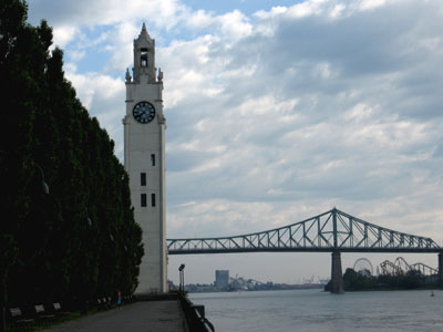
The “Tour de l’Horloge” with the Jacques Cartier Bridge in the background
After my initial investigation it was getting closer to race time. Now there was a whole animation team that was exhorting the runners to do calistenics to warm up for the big race. Several fitness experts on a podium were doing countdowns to the music (“a-one, a-two, a-three” – all of that in French, of course) while the members of the crowd were enthusiastically raising their arms and legs, pumping fists and doing all sorts of other warm-up exercises to get prepared for the start. Then, just a few minutes before 8 am, all the runners lined up in an area fenced in by a white picket fence and just a few moments after the official countdown began. Punctually at 8 am the gate was opened and the runners started running for Canada, to raise funds for Canada’s Olympic teams.
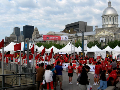
The runners are getting ready to start
Well, watching all this exercise made me look forward to my own activity-rich schedule, starting off with a bicycle tour in the morning. I walked about 10 minutes eastwards to Ça Roule, a bicycle rental and repair shop at 27 rue de la Commune that is a prime access point for travelers who want to discover Montreal by bicycle. You can rent bikes by the hour or by the day, and Ça Roule (also known as “Montreal on Wheels”) even offers guided tours. And that’s what I was going to take today: a guided tour accompanied by a licensed tour guide from Guidatour.
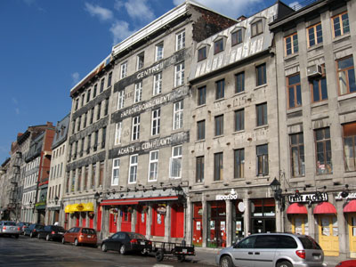
Harbourfront buildings in Old Montreal
First I went in the store to get outfitted, I got my bike (a very comfortable touring bike, I might add), a helmet, a detailed bicycle map of Montreal and a free bottle of water. Our tour group was congregating outside, we had a couple from Vermont, a young man from New York City, and a local gentleman who lives on the South Shore across the St. Lawrence River from Montreal who were going to take the tour with our licensed guide, Bruno.
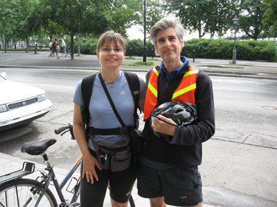
Bruno is going to take us on a guided tour
First Bruno took is into the port area to Quai King-Edward where we cycled out all the way to the tip from where we had a great view of the skyline of Old Montreal. From there we went eastwards to Place Jacques Cartier and pushed our bikes up the gently sloping square. Once at the top, right in front of Montreal City Hall, we got back on our bikes and went east to rue Berri where we were impressed by the Gare Viger, a former railway station built in the typical Chateau style that was so popular during Canada’s early railway era. Bruno indicated that this building will probably be renovated in the next two years and turned into an upscale hotel.
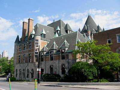
The Gare Viger, built in the once popular Chateau-style
Rue Berri is a major north-south thoroughfare in Montreal and what’s great about it is that it has designated bicycling lanes that are completely separated from the road traffic. We cycled past UQAM (Université de Quebec à Montréal), Bruno’s alma mater, and puffed up a couple of gently sloping yet longish hills. We had officially reached the Plateau Mont-Royal area. At the top, just north of Sherbrooke Street, we cycled into the Parc Lafontaine, the main green space in the Plateau area. The park was laid out in 1908, features two man-made lakes, tennis courts and bowling greens. Bruno mentioned to us that in the winter the waterways turn into a beautifully illuminated skating area. We stopped for a few minutes in the serene surroundings of the park. At the north end there was a map of Montreal’s extensive cycling network, right across from the “Maison des Cyclistes” which caters to bicycling enthusiasts.
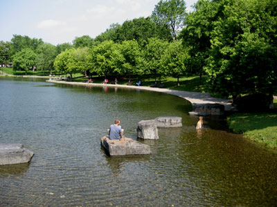
Serenity in the Parc Lafontaine
Bruno is an avid biker himself and said he has sold his car a while ago and uses his bicycle as his main mode of transportation. As passionate bikers we traded tidbits about the bicycling networks and our respective cities’ efforts to expand them and he made me aware that apparently Bay Street in downtown Toronto now has an official bicycling lane, something I wasn’t aware of. He also said that from Park La Fontaine you can cycle 252 km eastwards into the Eastern Townships region to the city of Sherbrooke. We both agreed that Quebec’s Eastern Townships are another area that is just predestined for bicyclists.
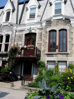
Houses in the St-Denis neighbourhood
Then we rode into the neighbourhood north of Parc La Fontaine and Bruno took us into some of the side streets that feature the typical Montreal external staircases. Our guide enlightened us that these staircases were built outside the buildings since families used to be very large, sometimes with 17 or 18 children. So people needed all the living space they could get and didn’t want to waste space on interior staircases. Furthermore, European travelers often ask why the houses have flat roofs. Bruno explained that the snow on the flat roofs would act as insulation in the winter and keep heating costs down. Secondly, pitched roofs would be dangerous since snow could slide and fall down right onto the sidewalk.
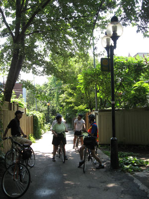
In the “ruelle verte”, the green alley
From the side streets we went into a back alley, a “ruelle verte” or “green alley”. The name comes from the fact that people have started to dedicate their time and attention to greening these little roadways. The city of Montreal has provided plants and vines to make them more attractive while the local residents upkeep the plant life and the flowers. Montreal has 12 of these “ruelles vertes” now and has started to turn previously ugly back alleys into little sanctuaries of urban greenery.
At the end of this alley Bruno showed us some examples of officially permitted graffiti, a recent city initiative that commissions local graffiti artists to show off their work legally, rather than defacing buildings with unwanted graffiti. Bruno mentioned he also does graffiti walking tours through the city, and I made a note of that for my next visit.
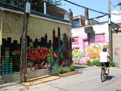
Local graffiti art
World Cup soccer passion was in full swing when we reached the intersection of Rachel and St. Laurent Streets. This residential area has been settled by a lot of Portuguese immigrants and one of the local bars was featuring a live broadcast of the England-Portugal World Cup Soccer match on a big screen. The bar and its patio were absolutely packed and people were chanting, screaming and making noise, and there was no doubt which side they were on. At the north-east corner of this intersection is the Parc des Ameriques which features an arch with design elements from different Latin cultures. A colourful Portugese church is right nearby and Bruno pointed out a variety of houses in the neighbourhood that show off brightly painted colour schemes, indicating a preference on the part of the Portuguese residents to liven things up a bit.
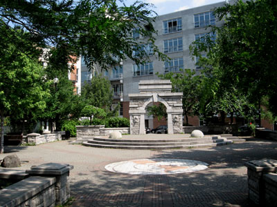
The Parc des Ameriques
We also found out that rue St-Laurent, also called “The Main”, was indeed the main street that immigrants took to settle in the city after arriving in the port area. For this reason rue St-Laurent is very ethnically mixed and Bruno explained that many new immigrants opened up shop here since they would be able to attract the Anglo crowd west of the “The Main” as well as francophone customers who tended to live east of rue St-Laurent. It is also the street that officially divides the city into east and west, so when you look at a Montreal address, pay attention to whether it has “east” or “west” after the street name. That will decide which way you will have to turn from rue St-Laurent.
Through the Plateau neighbourhood we cycled westwards until we reached Jeanne Mance Park at the foot of Mont Royal, another sizeable green space and a favourite spot for picnics, sunbathing, playing soccer, tennis or frisbee. We rested a little and then continued on towards Prince Arthur Street, a pedestrian street that today features a large selection of family style restaurants with outdoor patios. Antique lamp posts and cobble-stoned streets further add to the ambience in this area.
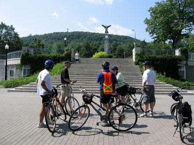
Enjoying a rest in Jeanne Mance Park
From Prince Arthur we cycled west and south into the “McGill Ghetto” area, a residential neighbourhood that hustles and bustles with students and features many frat houses and inexpensive eateries. Bruno took us into the McGill University campus, Montreal’s oldest university, founded in 1921 by Scottish fur-trader James McGill. McGill University is the centre of the “Golden Mile”, once the headquarters of the mostly Scottish bourgeoisie. It is said that in the late 19th and early 20th century about 70% of Canada’s wealth was concentrated in the hands of the residents of the Golden Square Mile and some of this power and opulence can still be seen in the few remaining luxurious Victorian mansions.
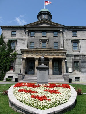
McGill University
From the university we were just a stone throw away from Montreal’s downtown, the conglomeration of skyscrapers built over the last 40 or so years that represents the centre of Montreal’s business world. We stopped at Place Ville Marie, a commercial highrise tower complex built in 1959 that gave rise to Montreal’s network of underground paths. Looking north on Avenue McGill College I had a view of of McGill University against the backdrop of the mountain, topped by the metal cross on Mount Royal.
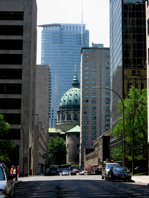
A glimpse at the Mary Queen of the World Cathedral
A few streets east Bruno took us into a small side street where we got a peak at the dome of the Mary Queen Queen of the World Cathedral which is rather dwarfed by the skyscrapers right around it. Bruno said that this is a favourite location for movie makers. From there it was not far to Victoria Square, originally a Victorian Garden in the midst of Second Empire and Renaissance Revival Stories most of which have since gone. The square was redesigned recently to reflect its original layout and the area around it has been renamed Montreal’s International Quarter. One of the key attractions of Victoria Square is an authentic Parisian Art Nouveau subway gate, the “Entourage Grimard”, named after architect Hector Grimard who designed the entrances to the Paris Metro. The Régie autonome des transport parisiens (RATP) offered this installation to Motnreal as a gift in 1966.
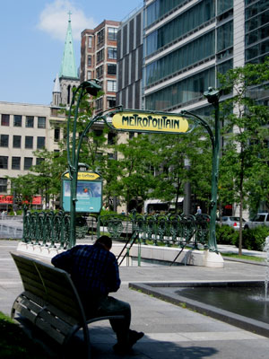
Victoria Square with an authentic Parisian Art Nouveau subway entrance
Victoria Square is an example of a very successful recent urban renewal project that now has wider sidewalks that accommodate up to 40% more pedestrians. Outdoor parking spaces were eliminated and more than 1300 new underground parking spaces were created in the surrounding areas. Trees, street furniture and decorative lighting further enhance the appeal of this square. Montreal’s World Trade Centre, a complex integrating the Nordheimer Building dating back to 1888, is located on the east side of Victoria Square. At the south end is rue St-Jacques (or St. James Street), until about the 1960s Montreal’s main business street, and the boundary of Old Montreal.
With the downtown portion of our tour complete we cycled back into Old Montreal and enjoyed looking at the old warehouses and the cobble-stoned streets. Our tour came to an end at Pointe-à-Callière, Montreal’s Museum of History and Archeology, where Bruno and the other cycling group members said goodbye. The great thing was that as part of the guided tour I would be able to keep the bicycle until 8 pm, a chance to continue my explorations on my own. I had asked Bruno for some advice on where to go and he recommended that I check out the Lachine Canal bicycle path that snakes along Montreal’s historic waterway, inaugurated in 1825. My explorations by bike would continue…
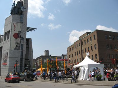
Finishing at Pointe-à-Callière
Susanne Pacher is the publisher of Travel and Transitions (www.travelandtransitions.com), a popular web portal for unconventional travel & cross-cultural connections. Check out our brand new section featuring FREE ebooks about travel.
photo credit-www.travelandtransitions.com
